
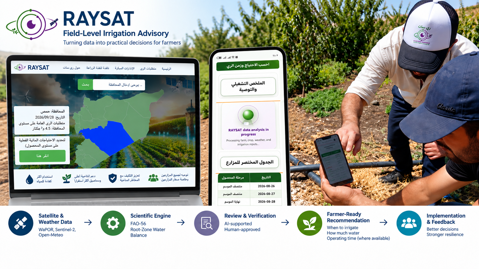
RAYSAT Irrigation Advisory

Farmer-Centered Climate-Smart Irrigation Advisory Framework

RAYSAT connects geospatial, weather and field information to practical irrigation decisions: when to irrigate, how much water to apply, how long to operate the irrigation system, and whether an early warning requires attention.

Functional MVP Controlled Pilot Use
WaPORSentinel-2Open-MeteoField Data
Scientific Engine
Established scientific methodologies supported by academic research
Whento irrigate
How muchwater to apply
How longto operate
Early warningwhat to prepare for
RAYSAT public platform, mobile advisory, field implementation and data-to-decision workflow

The Last-Mile Gap

Data are useful only when they become a field decision.

Weather and satellite data become operationally useful when they are connected to crop, soil, irrigation-system and field information and translated into clear actions.

RAYSAT provides this last-mile layer: technical complexity stays in the background while the farmer receives a clear recommendation and can report what happened in the field.

How RAYSAT Works

A traceable workflow from inputs to implementation.

Scientific calculation remains separate from review, communication and reported implementation.

01

Data Inputs

WaPOR + Sentinel-2 + Open-Meteo + field, crop, soil and irrigation-system data.

02

Scientific Engine

Established scientific methodologies supported by academic research estimate irrigation need and quantity.

03

Review & Verification

Inputs and outputs are checked against records, satellite indicators and field evidence.

04

Farmer Recommendation

Approved values are converted into a concise, field-ready message.

05

Implementation & Feedback

Reported implementation and observations return to the field record for follow-up.

Data Sources

Complementary data support the field decision.

Sentinel-2

Remote-sensing indicators for crop monitoring and review.

Remote-sensing indicators support crop-development monitoring and consistency checks against field records and calculated conditions.

They support review and verification rather than automatically replacing the root-zone water balance.

Open-Meteo

Daily weather and forecast inputs.

Open-Meteo provides operational weather and forecast data used in water-requirement assessment and early-warning functions.

Scientific Basis

Established Scientific Methodologies Supported by Academic Research

The scientific engine uses established scientific methodologies supported by academic research to assess irrigation timing and quantity using crop, soil, weather, irrigation-system and field-record information.

Where sufficient system information is available, approved irrigation requirements are translated into a practical operating time.

Farmer Outputs

01
When to irrigateDecision on irrigation need based on the approved field state.
02
How much water to applyField-specific irrigation quantity derived by the scientific engine.
03
How long to operatePractical runtime linked to the approved irrigation-system characteristics.
04
Early warningAdvance notice of relevant conditions that may require preparation or field attention.

AI-Supported, Human-Approved

AI assists the workflow. It does not replace the scientific engine.

AI-supported review helps flag missing or inconsistent information and supports checks against field records, remote-sensing indicators and observations.

The communication layer converts approved outputs into clear farmer-facing language without changing scientific values. Final operational release remains subject to human approval.

Operational guardrails

  • The scientific engine remains responsible for irrigation calculation.
  • AI does not invent missing scientific inputs or alter approved scientific values.
  • Uncertain cases can be held for verification before release.

Delivery & Feedback

The recommendation is connected to what happens next.

Approved recommendations can be delivered through familiar channels such as WhatsApp or SMS, with farmers able to confirm implementation or report what actually occurred.

Reported implementation and field feedback are linked to follow-up. A recommendation is not treated as implemented merely because it was issued.

Preliminary Evidence

Scientific and operational evidence supporting the framework.

These preliminary results retain their original unit of analysis and do not establish long-term effects on water use, energy use, yield or income.

User-perceived decision value 92.3%

Among 26 consensus group responses representing approximately 260 participants, 92.3% associated RAYSAT use with reduced guesswork in irrigation decisions.

End-to-end operational testing Traceable workflow

Tests documented the end-to-end path from recommendation generation and review through farmer-message delivery and follow-up of reported implementation.

Evidence boundary: some scientific assessments come from supporting research rather than direct tests of the current RAYSAT version. Longer comparative field trials are still required to quantify sustained effects on water use, productivity and economic efficiency.

Current Status

Functional MVP / Controlled Pilot Use

RAYSAT can complete the field-level workflow from preparation and calculation through review, communication and feedback. The advanced advisory system remains under controlled pilot use while validation and operational integration continue.

Public Platform

ray-sat.com is the public-facing service.

The public platform provides general water-requirement information and crop-water estimates. It remains distinct from the advanced field-level advisory workflow, which is not published as an open self-service system.

Contact

Research, partnerships and controlled pilot collaboration.

RAYSAT welcomes technical exchange, research collaboration, field validation and partnerships in farmer-centered irrigation advisory.